A short circular walk with fine views South of Etna.
Grade: |
Easy - moderate |
Distance: |
~10km |
Altitude Gained: |
~350m |
Duration: |
3.5 hours |
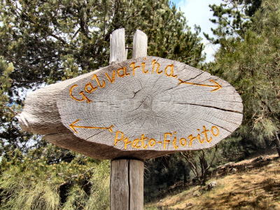
Right: Much of the circum-Etna trekking route is clearly signed by a series
of waymarkers, such as the one pictured here.
© Mat & Niki Adlam-Stiles, 2007
|
|
Walk in brief:
Mount Etna draws you towards her summit craters as if some mysterious, invisible force is compelling you to climb her ashy slopes.
But at over 10,000ft high, it
is not uncommon for the weather to be against you, with thick cloud shrouding the upper slopes of the mountain.
The lower-level walking on Etna has much to commend it - lush pine forests packed with a curious variety of indigenous plants,
contrasted with the barren destruction inflicted by more recent lava flows. So if the weather is less than clement up-top,
or if you need a more gentle day, this short circular walk on Mount Etna comes highly recommended.
For the more energetic, the route described makes an ideal moutain bike trail, being on reasonable off-road terrain throughout.
The trekking route described could be combined with more of the Circum-Etnea navigational routes.
The approach from Nicolosi:
Follow the signs from Nicolosi for "Etna Sud" and you will soon find yourself on the steeply
ascending road heading towards Rifugio Sapienza, and the Etna Sud Cable car. You want the North West
road exiting Nicolosi past the Monti Rossi Crater, a lushly vegatated mound that will be on your left as you head Northwards.
Signposts seem somewhat lacking here, but as you start to climb towards Etna, look out for what is really the only decent
sized turning left. If you get to the restaurants (on the left) part way up, and a layby (on the right) sporting one or more stalls selling lava Madonnas,
you've gone too far!
Almost immediately after the left turn, a
smaller right turn is taken, heading towards Adrano. Stay on the "main" road for 12 km, and you should see
a sign for a turning on the right - Monte Intraleo. At the time of writing (June 2008), this could only be seen when approaching from the
opposite direction!!
Follow the Monte Intraleo road to the car park at the end, which is the starting place for the walk.
The Route to Rifugio della Galvarina:
|
From the cark park, take the obvious forestry track at the far end - there is a
stile just to the left of the large gates. After a short distance, as you reach the edge of the wooded area, an
obvious junction is reached - the outward route takes the right hand track, we return
via the route on the left.
|
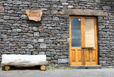
The basic, but excellent Rifugio della Galvarina. © Mat & Niki Adlam-Stiles, 2007
|
Follow the foresty trails and obvious signs for the Rifugio, through lushly vegetated pine forest. You'll likely encounter the
occasional mountain biker or dog walker, but in general we found the routes to be very quiet and peaceful indeed. Depending on
the time of year you are visiting, you will likely encounter a fascinating range of indigenous plants, including rock roses and
the "Etna" mountain pansies.
As you skirt along the edge of the woodland, you'll pass a track on the left, followed shortly after by the main route bearing left
at a junction. This left starts to climb moderately, and takes us deeper into the woodland, passing the ancient volcanic craters of
Monte Forno on the left, and once the trail has swung right (fork right), Monte Albano on the right (South).
The Etna hiking trail / forestry track continues Eastwards, climbing gently, until an obvious T junction is reached. Our route takes
us left, but it's worth a 2 minute detour down the right-hand route for great views of Etna South, and down to the Catania coast.
Continuing to climb gently, the path eventaully clears the woodland to break out onto more scrubby, lava-strewn terrain. Continue to
hike uphill to the large and obvious T junction (note this point for the return), turn right, and Rifugio della Galvarina will soon
come into sight. The Rifugio is usually open, and makes a fine lunch spot.
Return by retracing your footsteps to the first major junction as noted above, but instead of turning right, keep straight ahead. A
straightforward foresty track leads you back down to the woodlands, and eventually to the car park, passing Monte Nespole on the right
as you go. The track is generally well signed, with only the last junction persenting any scope for route finding difficulties!
A pleasant 1/2 day hike on the Southern Flank of Etna.