
 |
Like our website?
'Like' us on Facebook... |
|
|
Have you found this site useful? If so,
why not make a small contribution to our running costs. Just click
on the button below for more details:
|
Walking in the Peak District, Derbyshire, UK - Wincle and the Gritstone Trail |
A medium length cicular walk on the edge of the Peak District.
Grade: |
Easy - moderate |
Distance: |
10km |
Altitude Gained: |
~350m |
Duration: |
~3 hours |
To the Western edge of the Peak District National park lies the parish of Wincle. Relatively quiet
by Peak District terms and easily overlooked, this interesting walk combines a section of the Dane
Valley way with part of the Gritstone Trail.
|
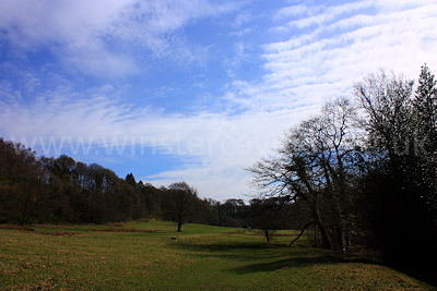
Above: The riverside pastures near Wincle - May 2010
© Mat & Niki Adlam-Stiles, 2010
|
Walk in brief:
A circular walk without any real difficulty and just 350m (approx) of climbing,
broken into several small sections. The walk mixes canal-side and riverside
strolling with wooded valleys and open farmland, and some excellent views across
the Macclesfield plains. There is plenty of scope to extend, or shorten the
walk as required.
The start / end point is the small village of Wincle, in which an excellent and
popular village pub with plenty of outdoor seating welcomes walkers.
The walk is covered by the 1:25,000 Ordnance Survey map OL24 (White Peak)
|
|
|
|
|
The Dane Valley way:
Our walk starts
in the small village of Wincle, where roadside parking can usually be found
close to the village pub (SJ962653).
From the pub, walk South down the hill, and after a few yards a gate and path of
the right will take you down to the riverside. From here, a gentle stroll
downstream (South) through mostly level farmland will bring you, after ~1.5km,
to a footbridge and weir.
|
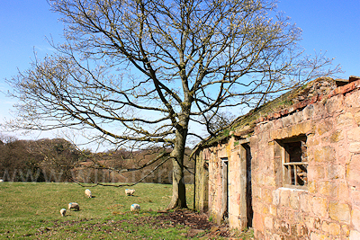
Above: Looking towards Cartlidge wood, May 2010
© Mat & Niki Adlam-Stiles, 2010
|
|
Cross the footbridge and turn right, to pick up the old towpath along the
disused canal, where easy walking for a further 1.5km brings you you a junction
where the Dane Valley Way and the Gritstone Trail meet.
The Gritstone Trail:
Take the right at the junction to pick up the Gritstone Trail - You drop breifly
to cross the river at Barleigh Ford Bridge, before a short and moderately steep
climb takes you up above the wooded valley. Passing a path on the right,
and an old barn on the left, a 4-way junction is met. The right could make
for a much-shortened return route to Wincle. Our route takes the left,
dropping steeply down to the valley floor, before climbing out the other side to
the farm buildings at Hawkslee. As you approach the farm the path can be a
little confusing - head for the lane to the left of the buildings.
|
|
From Hawkslee, the Gritstone trail follows the unfenced lane North (up!) to
increasing open pasture / moorland. As the lane climbs, the views become
more and more open. To the left, you get far-reaching views over the
Macclesfield plains, with the large radio telescope of Jodrell Bank being a
prominent feature.
We continue up the lane for ~1.25km until, some way short of the summit, a
second path of the right is reached (SJ941664). Follow the path that initially
zig-zags down the hill to bring you to the farm at Butterland. Here, a
permissive route neatly keeps you out of the farmyard itself, and you soon turn
right (South) to start making your return journey.
|
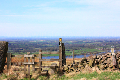
Above: Looking across the Macclesfield plains to Jodrell Bank, May 2010
© Mat & Niki Adlam-Stiles, 2010
|
|
As you follow the path around a field perimeter it turns right. Be careful not
to overshoot the footpath, which heads South down the open ridge of Nabs Hill,
and into the pleasant wooded valley at Greasley Hollow. Cross the footbridge to
climb back out of the valley.
Shortly after the (rather untidy) farm at Lower Greasley, a path right will
return you to the wooded valley, which is followed upstream for just over 1/2km
to a junction. Right here climbs out of the valley into open pastureland.
~200m further up, a right-left staggered junction continues to climb upwards to
the rather fine Wincle Grange. Turn right onto the lane, and after ~200m
another path on the right will return you to your starting point at the pub in
Wincle.
|
|
|
|
|
|