Walking in the Lake District, UK - Latterbarrow, Hawkshead |
A short cicular walk, with far-reaching views.
Grade: |
Easy |
Distance: |
5km |
Altitude Gained: |
250m |
Duration: |
2 hours |
A short distance from the tourist honey pot of Hawkshead lies the small and often-overlooked
hill of Latterbarrow.
The ascent of Latterbarrow, coupled with walking in the adjacent woodland offers
a fine and easy cicular walk with good panoramic views. The walk could be
easily extended.
|

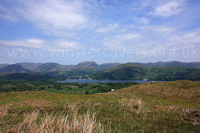
Above: The views from the summit of Latterbarrow, near Hawkshead - May 2010
© Mat & Niki Adlam-Stiles, 2010
|
Walk in brief:
A cicular walk without too much difficulty and just 200m of climbing. A
great option as a stop-off on the way home that takes in open countryside with
some fine views, and a walk through pleasant woodland.
The nearby village of Hawkshead has plenty of options for refreshments, although
parking can be at something of a premium, especially on busy weekends.
|
|
|
|
|
The ascent of Latterbarrow:
Our walk starts
approximately 1km outside of the village of Hawkshead. From the village centre,
take the B5282 towards "The Sawreys" and the Windermere ferry.
Just outside the village, a turning left on an unmarked road will take you past
the hamlet of Colthouse. There are a few options for roadside parking for
a very small number of cars near Gillbank - approx. NY 360987
|

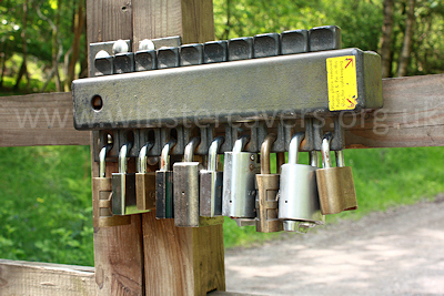
Above: The ingenious lock on the forestry track gate, May 2010
© Mat & Niki Adlam-Stiles, 2010
|
|
The walk starts in earnest where a footpath leaves the unmarked Colthouse - High
Wray road at NY 363993. The main footpath heads South East and skirts
around the South side of Latterbarrow, but after a very short distance you'll
see a more popular track heading direct for the summit. This is our route,
and after a short but steep climb you will be rewarded for your efforts with
excelent panoramic views, especially to the North, where some of the mightier
crags dominate the distant skyline.
From the summit, a permissive route descends Northwards - on the open hillside
at first, before entering the woods. After a little over 1/2km, the
permissive path intersects a forestry track on a hairpin bend. Following
the track left soon brings us to "Basecamp" (NY 372995). The ingenious
lock arrangement on the gate across the track is to allow any one lock owner to
open the gate.
From basecamp, a bridleway way heads right (South East) before intersecting an
array of forestry tracks. Keep straight ahead until you reach the 4-way
junction at Scab Moss (NY 378986). Turn right here ascending slightly
through the woods. Go straight ahead at the next 4-way junction, and from
here the navigation is simple. The bridleway will take you through a mix of open
and wooded areas, to eventually descend through Colthouse plantation, and emerge
on the Colthouse - High Wray road 3/4 km South of our starting point.
|
|
|
|
|