
 |
Like our website?
'Like' us on Facebook... |
|
|
Have you found this site useful? If so,
why not make a small contribution to our running costs. Just click
on the button below for more details:
|
Walking on Etna - Monte Fontana and the Valle del Bove from Zafferana Etnea |
A superb and relatively easy low-level hike into the impressive the Valle del Bove
Grade: |
Easy/moderate |
Distance: |
~10km |
Altitude Gained: |
~300 |
Duration: |
3 hours |
Right: the result of an enormous landslip, the Valle del Bove is one of the most impressive features on Etna. Looking down on the Valle from above
it has the appearance of an impenetrable wilderness - but approached from the right direction, it is far less intimidating than one might
think.
|
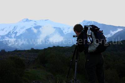
The Valle Del Bove, May 2009
© Mat & Niki Adlam-Stiles, 2009 |
Walk in brief:
From high up on the slopes of Mount Etna, the Valle del Bove is an imposing looking place. Sheer cliffs bound the North,
West and South sides of the Valle, and the interior takes on the appearance of a lunar landscape – pitted and charred by
successive flows of molten lava, fresh from the jaws of Mount Etna.
It is true to say that those venturing into the Valle should do so with some caution, but it is also fair to say that the
Valle presents a splendid opportunity for some lower level hiking, some excellent views, and a sense of remoteness that is
difficult to equal.
This relatively gentle out-and-back walk provides a fine introduction to the Valle’s magnificence, and a taster of the challenges navigating within the Valle Del Bove can bring.
The approach from Zafferana Etnea:
Our start for this walk is on the outskirts of the beautiful town of Zafferana Etnea, that sits poised
delicately at the foot of the Valle del Bove.
Heading out from Zafferana Etnea towards Milo (North) you pass a Tamoil petrol filling station (which seems to be in a continually varying state of being in business,
or not!) on the left.
After the petrol station, take the third turning on the left, heading steeply uphill on a narrow cobbled street.
Keep heading right and up (Ballo)
until the road ends at a gate, with terraced vineyards all around, some in a better
state of repair than others. There’s plenty of space to park here without blocking access to the neighbouring fields.
Monte Fontana and the Valle del Bove:
|
From the cark park, go through the gate and take the obvious track heading upwards and towards Etna's higher ground, passing under a pylon after ~1km and reaching
a junction after another 0.5km. Keep left here.
The main 1:25,000 map of Etna shows a path striking off to the left ~200m past the
junction, which heads directly to Monte Fontana. The turning is marked by
a small, vague cairn, but the track seems to have largely fallen into disuse. You're far more likely to reach Monte Fontana if you continue along the made-up track and, like
some of our fellow Etnaphiles, view the direct route as "pure fantasy".
|
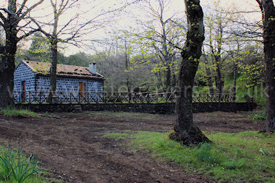
The forest "rifugio" passed shortly before the lava fields. © Mat & Niki
Adlam-Stiles, 2009
|
|
A gate soon brings you to a larger track - follow this left to enter a maze of forestry
tracks that can easily have you walking around in circles. After a short distance,
a left turn (marked with red and white hazard tape tied to the trees at the time
of writing) will bring you one of the many Forest refuges on Etna. Do not
follow the main track that passes along the front of the refuge to soon ending at
a large gate. Instead, as you are facing the refuge, head to the back-right
corner. From here, a smaller footpath, marked with the traditional array of
cairns and sticks climbs very briefly and almost immediately strikes out across
the lower fingers of the 1986 - 1987 lava flows.
For a track across the lava, this one is pretty easy going, giving you time to marvel
at the immense and seemingly inpenetrable cliffs of the Valle del Bove, to enjoy
some clear views to Enta's summit, and down to the sea below. As your views
become less and less obscured, you may be able to make out some of the key features
on the flanks of the Valle Del Bove, such as Monte Zoccolaro and the Schiena del
Asino to the left of the Valle, and Pizzi Deneri to the right.
|
|
|
|
|
|
Having crossed the lava fields, you'll soon arrive at a clearing to the East on
Monte Caliato, where a sign by a derelict refuge helpfully points out the return
route.
The track, which is not always obvious, continues North, trending westwards as you
skirt around the North side on Monte Caliato, before picking up a more distinct
path to the short climb up Monte Fontana itself.
Either return via the outward route or, if armed with the correct walking map, a
theoretical (but not tried and tested by us) route heads East from Monte Caliato
giving the option of a circular walk.
|
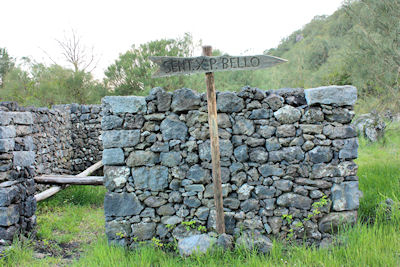
The derelict forest "rifugio" near Monte Caliato. © Mat & Niki
Adlam-Stiles, 2009
|
|
The map below is for guidance only, and may not be 100% accurate!
View Walking On Etna-2008 in a larger map
|
|